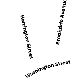
15 HARRINGTON ST
Owner Information
NEWBURG KATHRYN J
15 HARRINGTON ST
NEWTONVILLE, MA 02460


Property Details
15 HARRINGTON ST is classified as a Single Family Residential (Cape cod).
The primary structure on this property was built in 1923. There are 4153ft2 of built area within this property. There is 1993ft2 of residential/living space within this property. This property is listed as having 8 rooms.
15 HARRINGTON ST is valued at 804200. The land is valued at 616000 and the structures are valued at 188200.
This property is in Zone MR1. Confirm with local Zoning Board authorities to ensure there are no overlays or other easements on this property.
The most recent deed for 15 HARRINGTON ST is recorded at the local registrar in Book 23531, Page 250. 15 HARRINGTON ST was last sold on 1993-08-01 for 1.
Assessment data from fiscal year 2022.
Flood Data
According to the FEMA National Flood Hazard Layer, this property does not appear to be in a flood zone. It may also be in an area not yet reviewed. Nonetheless, confirm this information prior to taking any action.
To view the flood hazards around this property, create a FEMA "Firmette" Map of the area around 15 HARRINGTON ST.
Broadband Internet Providers
| Provider | Type | Bandwidth (mbps) | |
|---|---|---|---|
| HughesNet | Satellite | 25 | 3 |
| VSAT Systems, LLC. | Satellite | 2 | 1 |
| Viasat Inc | Satellite | 100 | 3 |
| Verizon New England Inc. | DSL | 5 | 0 |
| Verizon New England Inc. | Fiber | 940 | 880 |
| Comcast | Cable | 1000 | 35 |
| RCN | Cable | 500 | 20 |
| RCN | Cable | 1000 | 20 |
| GCI Communication Corp. | Satellite | 0 | 0 |
Broadband service provider data from December 2020.
Adjacent Properties
- 466-468 ALBEMARLE RD
Two-Family Residential owned by CHEN JIAHUA - 11 HARRINGTON ST
Single Family Residential owned by KELSO BARTON L & PRISCILLA L L/E - 21 HARRINGTON ST
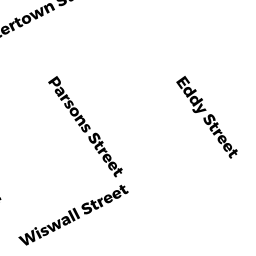
Two-Family Residential owned by DALY FRANCIS B JR & JANICE - 46-48 EDDY ST #46
Residential Condominium owned by KATZ EMANUEL & ILANA TE - 46-48 EDDY ST #48
Residential Condominium owned by ROSENBLATT ANDREW - 46-48 EDDY ST
Other, Open Space owned by 46-48 EDDY ST MASTER DEED - 42-44 EDDY ST #44
Residential Condominium owned by FIALKOWSKI DOROTHEA - 42-44 EDDY ST
Other, Open Space owned by 42-44 EDDY STREET MASTER DEED - 42-44 EDDY ST #42
Residential Condominium owned by AMATUCCI SUE M & JOSEPH - 38-40 EDDY ST
Two-Family Residential owned by ZHANG YUAN WEI